


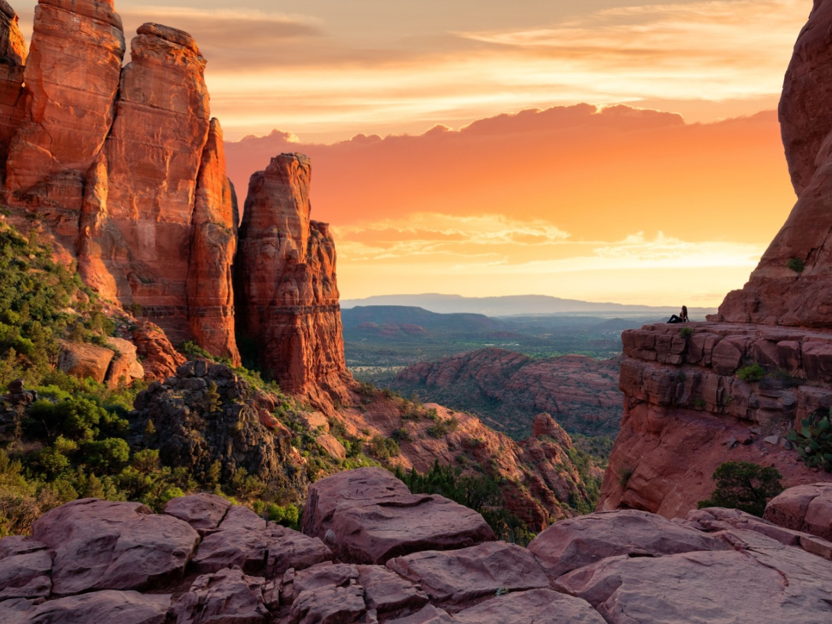
Sedona, Arizona, isn’t just a destination—it’s an experience carved in crimson stone. The Sedona hiking trails offer a breathtaking mix of rugged canyons, smooth red rock formations, and mystical vortex sites that attract travelers from all over the world. Whether you’re chasing the sunrise over Cathedral Rock, hiking into the shadows of Soldier Pass, or exploring hidden canyons with ancient petroglyphs, Sedona’s trails promise adventure at every turn.
According to the Sedona Chamber of Commerce, more than 3 million visitors come to Sedona each year, and hiking ranks among their top three activities. With more than 200 trails covering over 400 miles, there’s truly a path for every skill level—from casual strollers to seasoned trekkers.
In this complete trail guide, we’ll explore the best hiking routes, tips for visiting, when to go, where to stay, and how to make the most of your Sedona outdoor adventure. Start your vacation right now with Your Sedona Travel Experts.
Why Sedona Is a Hiker’s Paradise
The Magic of Red Rock Country
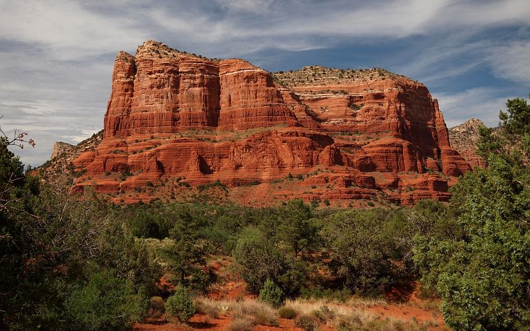
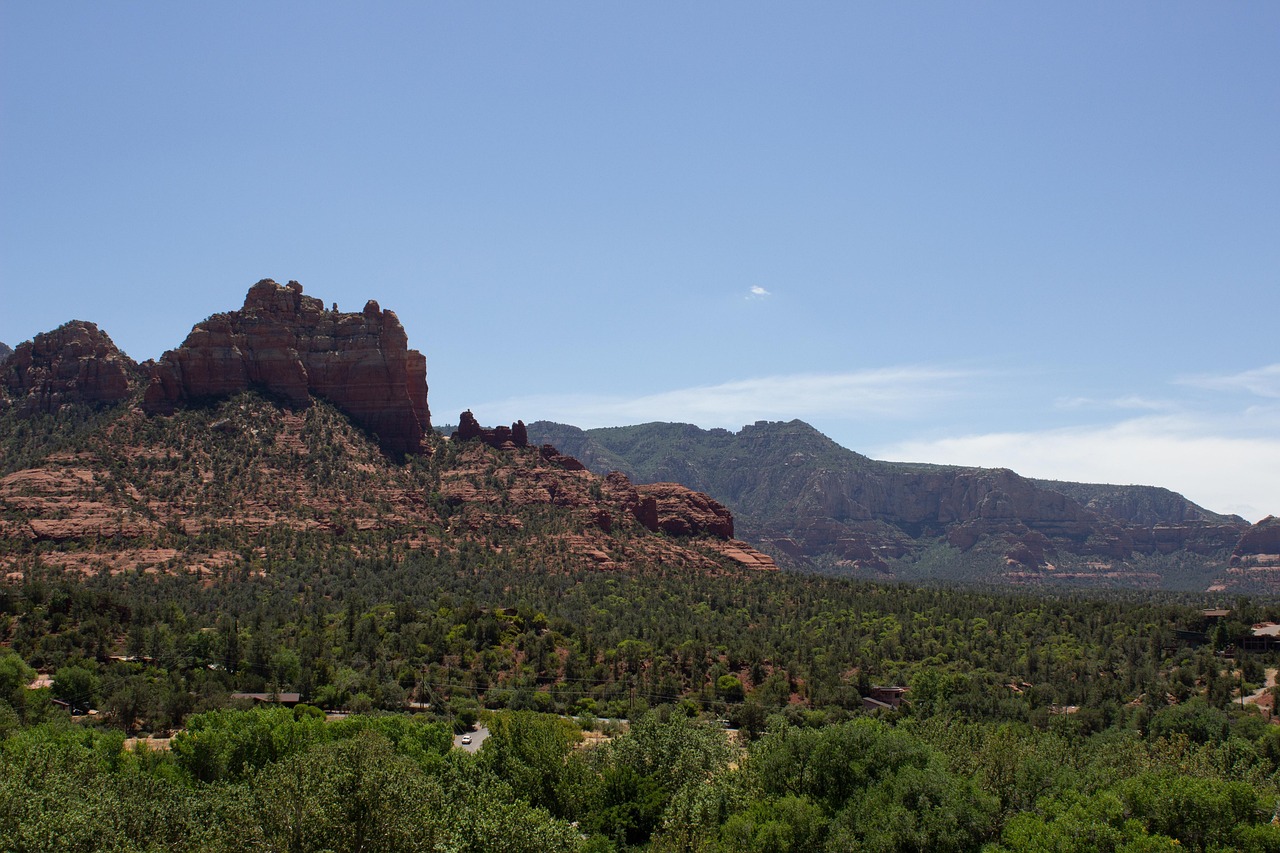
Sedona’s surreal red landscape was sculpted over millions of years by wind, water, and time. The iron-rich sandstone glows in hues of deep orange and bright crimson—especially at sunrise and sunset. What sets Sedona apart from other hiking destinations isn’t just its scenery, but its spiritual energy. Many locals and visitors believe Sedona sits upon “vortex sites,” areas of concentrated earth energy that enhance wellbeing and consciousness.
For those seeking a deeper connection with the land, consider joining a guided hiking experience led by local experts. Many guides weave geology, history, and spirituality into their tours, enriching your understanding of Sedona’s landscapes and legends. From exploring hidden ruins to learning the names of desert plants that thrive in crimson soil, guided hikes turn every step into a story — and every view into an opportunity for reflection and discovery.
Easy Access and Variety
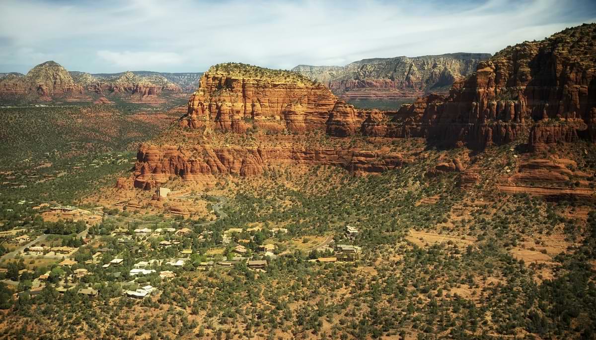
Unlike many national parks or wilderness regions, Sedona’s trailheads are easily accessible from town. Most top hikes are within a 10-15 minute drive from central Sedona, making it possible to tackle multiple trails in one day. Trails vary from smooth, flat meanders through juniper and cypress to steep climbs up slickrock spires.
Perfect Weather for Outdoor Exploration
Sedona enjoys over 300 days of sunshine per year, making it perfect for year-round hiking. Winter months are mild (50s–60s °F in daytime), while spring and fall bring ideal hiking temperatures in the 70s. Summer can be hot, but early morning or evening hikes offer glowing views and cooler conditions.
Top Sedona Hiking Trails You Can’t Miss
Below are Sedona’s most beloved hiking experiences, each offering a unique perspective of the Red Rock wonderland.

Cathedral Rock Trail
Distance: 1.2 miles round-trip
Elevation gain: 750 feet
Difficulty: Moderate–strenuous
Trailhead: Cathedral Rock Trailhead, Off Back O’ Beyond Road
Cathedral Rock is Sedona’s iconic hike—and perhaps one of the most photographed spots in Arizona. The steep, short climb to the saddle rewards hikers with jaw-dropping views of the Verde Valley and Oak Creek below. Rest at the top to soak in both the panorama and the stillness—many say this is one of Sedona’s strongest energy vortex sites.
Devil’s Bridge Trail
Distance: 4.2 miles round-trip
Elevation gain: 564 feet
Difficulty: Moderate
Trailhead: Dry Creek or Mescal Trailheads
The famous Devil’s Bridge is a natural sandstone arch that stretches dramatically above the canyon floor—a must-see for first-time visitors. The scramble to the top can get crowded, so start early to beat both the heat and the selfie-seekers. The views from the bridge are unforgettable and perfect for photos.
Soldier Pass Trail
Distance: 4.5 miles round-trip
Elevation gain: 600 feet
Difficulty: Moderate
Trailhead: Soldier Pass Trailhead (limited parking—arrive early)
Soldier Pass offers a fascinating mix of history, geology, and mystique. Hikers encounter the Seven Sacred Pools, a series of natural basins that fill with rainwater, and the mysterious Devil’s Kitchen sinkhole, a massive collapsed sandstone cavern formed in the 1800s.
This trail connects with the Brins Mesa loop for those who want a longer, more scenic adventure. U.S. Forest Service Sedona Trails Map for official route details and regulations.
West Fork Trail (Oak Creek Canyon)
Distance: 6.9 miles round-trip
Elevation gain: 600 feet
Difficulty: Easy–moderate
Trailhead: West Fork Trailhead on State Route 89A
This lush canyon trail contrasts sharply with Sedona’s desert environment. You’ll cross Oak Creek multiple times beneath towering red rock walls and leafy sycamores. West Fork is one of the best Sedona trails for families, shaded walks, and photography—especially in fall, when the canyon transforms into a mosaic of gold and amber leaves.
Boynton Canyon Trail
Distance: 6.1 miles round-trip
Elevation gain: 974 feet
Difficulty: Moderate
Boynton Canyon blends dramatic views, ancient cliff dwellings, and a spiritual tranquility unique to the region. The trail winds into a red-walled box canyon surrounded by juniper and manzanita. Halfway in, hikers encounter the Boynton Vortex—another well-known energy center.
Pro tip: Combine this with the nearby Subway Cave trail spur for a memorable off-the-map experience.
Bell Rock and Courthouse Butte Loop
Distance: 4 miles round-trip
Elevation gain: 357 feet
Difficulty: Easy–moderate
Bell Rock is visually striking and easily accessible. Known for its bell-like shape, it’s one of the easiest Sedona hikes for first-timers. The loop connecting Bell Rock and Courthouse Butte offers panoramic views and exposure to Sedona’s best light—especially at sunrise.
Airport Mesa Trail
Distance: 3.5 miles round-trip
Elevation gain: 416 feet
Difficulty: Moderate
Airport Mesa delivers 360-degree views of Sedona’s core formations—Cathedral Rock, Bell Rock, Courthouse Butte, and more. It’s especially stunning at sunset, though parking can be limited. The short spur to the Airport Vortex viewpoint is an excellent spot for meditation or an evening picnic.
Fay Canyon Trail
Distance: 2.4 miles round-trip
Elevation gain: 190 feet
Difficulty: Easy
Perfect for beginners or anyone seeking a relaxed stroll through beautiful red cliffs. Fay Canyon is shaded, easy to access, and leads to a natural arch—perfect for families or afternoon hikers seeking relief from the heat.
Doe Mountain Trail
Distance: 1.6 miles round-trip
Elevation gain: 500 feet
Difficulty: Moderate
This short, steep climb rewards hikers with a broad, flat mesa and panoramic views of Sedona’s western canyons. Many locals consider Doe Mountain one of the most underrated Sedona trails.
Bear Mountain Trail
Distance: 5 miles round-trip
Elevation gain: 1,900 feet
Difficulty: Strenuous
Bear Mountain is not for the faint-hearted—but for seasoned hikers, it’s one of Sedona’s most satisfying summits. The trail climbs steeply over layered sandstone with continuous, photo-worthy vistas. Bring plenty of water and start early.
What to Bring on Your Hike
Sedona’s terrain can be challenging. Proper preparation ensures a safe and enjoyable experience.
- At least two liters of water per person
- Sunscreen, hat, and sunglasses (year-round)
- Lightweight hiking shoes with traction
- Trekking poles for uneven rock
- Maps or GPS (cell service may drop)
- Snacks such as trail mix or energy bars
- Camera for those epic red rock shots
Responsible Hiking and Trail Etiquette
Preserving Sedona’s fragile desert ecosystem ensures it can be enjoyed for generations. Follow Leave No Trace principles:
- Stay on marked trails. Shortcutting causes erosion.
- Pack out all trash—even organic waste like fruit peels.
- Do not remove rocks or carve names into stone.
- Respect wildlife and other hikers.
- Avoid drones in wilderness zones.
For official rules and trail updates, check the Coconino National Forest Travel Information
Insider Tips from Local Hikers
- Start early—by 7:00 AM in spring and fall—to enjoy cool conditions and fewer crowds.
- Visit on weekdays if possible; weekends draw large numbers of tourists.
- Download offline maps from AllTrails or Gaia GPS before heading out.
- Watch for monsoon storms from July–September; flash flooding can occur suddenly.
- Respect vortex seekers and spiritual visitors—Sedona means different things to everyone.
Pair Your Hike with Sedona Experiences
Make your trip even more memorable with nearby attractions:
- Sedona Jeep Tours: Explore remote canyons only accessible by 4×4.
- Tlaquepaque Arts Village: Browse local art and dining in Spanish-style courtyards.
- Sedona Stargazing: With minimal light pollution, the night sky dazzles.
- Vortex Tours and Spiritual Healing: Learn about Sedona’s metaphysical side.
- Oak Creek Wine Trail: Sample Arizona’s growing vineyard scene post-hike.
Each of these experiences complements your outdoor adventures and rounds out a full Sedona itinerary.
A Hiker’s Day Itinerary in Sedona
For those who want a perfectly balanced day of hiking, relaxation, and sightseeing, here’s a sample itinerary:
Morning – Sunrise hike to Bell Rock, followed by coffee and breakfast in Village of Oak Creek.
Late morning – Explore Cathedral Rock or Soldier Pass before midday heat.
Afternoon – Visit Tlaquepaque for lunch and art shopping.
Evening – Sunset at Airport Mesa, dinner at a scenic restaurant with red rock views.
Night – Stargaze from your private deck or outdoor firepit at your vacation rental.
Planning Your Trip: Getting to Sedona
Sedona is about 2 hours north of Phoenix and 45 minutes south of Flagstaff via Highway 89A or I-17. Most travelers arrive via Phoenix Sky Harbor International Airport and rent a car for flexibility. Shuttle services are also available for visitors without vehicles.
If you plan to explore multiple trailheads, a car is highly recommended—some routes have limited parking or dispersed access points.
for travel logistics and current road conditions.
How to Photograph Sedona’s Trails Like a Pro
Sedona’s trail system isn’t just for hikers — it’s a playground for photographers, yogis, and stargazers too. Early mornings often bring mist in the canyons, creating ethereal backdrops for sunrise yoga or mindfulness sessions. As the day fades, the dark sky above transforms into a glittering canvas, perfect for astrophotography. Thanks to Sedona’s recognition as a Dark Sky Community, visitors can enjoy brilliant constellations with minimal light interference — a rare treat in today’s world. A few insider tips:
- Golden Hour: Photograph 30 minutes after sunrise or before sunset for glowing colors.
- Polarizing filter: Helps deepen the sky and cut glare from sandstone.
- Foreground interest: Include cacti, stones, or footprints for dimension.
- Drone alternatives: Use wide shots from high overlooks to capture scale.
- Steady your camera: Use a tripod for panoramas at spots like Doe Mountain or Cathedral Rock.
The Trail to Your Perfect Sedona Vacation
Sedona hiking trails offer more than just stunning views—they invite connection, reflection, and rejuvenation. From the timeless rock spires to the whisper of desert wind through junipers, every step tells a story millions of years in the making.
Whether you’re scaling Cathedral Rock, discovering hidden canyons, or meditating at a vortex site, Sedona’s trails promise memories that linger long after your boots are dusty.
After your adventures, relax in comfort with a Sedona vacation rental—just minutes from the red rocks you’ve explored. With cozy interiors, breathtaking views, and personalized amenities, your stay becomes part of the journey.
Plan your Sedona getaway today. The red rocks are waiting.